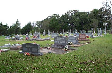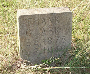
We are indebted to Kathy Carter, former director of the Fayette Heritage Archives and Museum, for the following cemetery information. Most of these cemeteries were visited by Kathy Carter, Helen Muras and Annette Ruckert in the late 1980s and early 1990s. The Archives staff will check their extensive cemetery database for you by e-mail. All you need is a surname. You do not need to know the name of the cemetery.All cemetery photos by Rox Ann Johnson unless otherwise noted. If you have a photograph or information about a cemetery you'd like to contribute to this site, please contact Rox Ann.
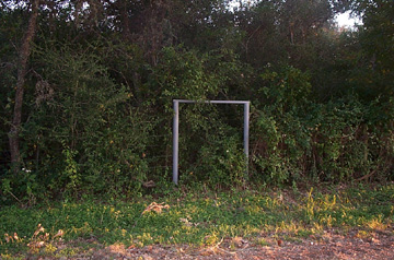
Card Grave
MuldoonAccording to Joe Cole, c.1958, this site is on a tract of land owned by a Mrs. Mitcher/Mitchell who is the wife of a doctor. It is the grave of a little child, the daughter of Sam Card, There is no marker, only a cedar picket fence around the graver. The grave is is the yard of the old Card home. (Sam Card is buried in Cedar Cemetery.) Sam Card sold this site to G. W. Cole in about 1870. The grave was three miles east of Muldoon and one mile south of old L. Kelley place [Joe Cole #023W].
Carmine City Cemetery
Carmine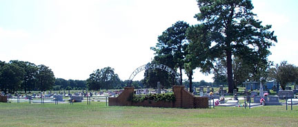
30°08'30"N 96°41'25"W
The three-acre Carmine City Cemetery is located on Carmine Cemetery Road, just southwest of town. Its first recorded burial was Fritz Lehman who died October 27, 1888. The Carmine Friedhofs Gemeinde (Carmine Cemetery Association) was organized in 1894 and, for many years, the minutes and by-laws of that group were written in German. A decorative metal arch over a brick flower box was added to the property in 1965. The cemetery is the resting place for over 500 persons.
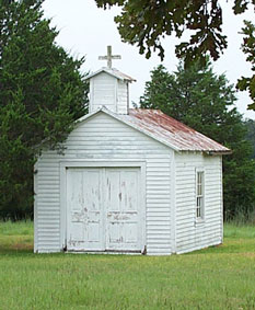
Castleman Family Cemetery
Flatonia29°38'29"N 97°07'40"W
See history, photos and list of burials in the Castleman Family Cemetery.
Castleman Grave
Manton Spring
In May 1958 Joe Cole reported: "One grave at Manton Spring. Supposed to be one of the Castleman's. The grave is lost. Buried about 1830. About 5.5 miles west of La Grange on the old Plum gravel road. (Willie Snider. May 1958) / in gravel pit - J. Cole."
Cedar Cemetery
29°51'27"N 96°55'56"W
Texas Historical Commission Marker
See history, photo and list of burials in Cedar CemeteryCedar Creek Cemetery
Muldoon
Historic Texas Cemetery designation
See history and list of burials in Cedar Creek Cemetery
Cesko Narodni Hrbitov
[Czech National Cemetery] Also known as Ellinger Public Cemetery, Ellinger City Cemetery, Ellinger National Cemetery and C. S. P. S. Cemetery
See text of historical marker and a list of burials in the Cesko Narodni Hrbitov.
Charpentier Family Cemetery
Formerly located near Halsted
According to Norman C. Krischke: "The Charpentier Family Cemetery was located on the old Carl Wolle Estate, later Terrance E. Stewart's land, now owned by the Lower Colorado River Authority. The cemetery was located about 400 yards east of the Wolle Family Cemetery."
According to Joe Cole in 1959: "This family cemetery was originally located 1.5 miles northeast of Halsted, Texas on the George Wolle estate. Louise Charpentier born July 27, 1837, died September 20, 1880. Two unmarked graves. The three graves are on a high hill under some oak trees about 400 yards east of the Wolle graveyard (#114E). There is an old log cabin just north of the 3 graves about 100 yards. Located Aug. 20, 1959 through Eliza Ogelsby Gardt?."
In 1973-1974 the Lower Colorado River Authority of Austin purchased land in Fayette County for the construction of the Fayette Power Project. Several cemeteries were in the boundaries of the project acreage. All the affected burials were disinterred and moved to new sites. Descendants of the deceased were contacted and signed permits were obtained to allow the work to proceed. More than 125 burial sites were involved in the relocation project. The bodies were moved to the New La Grange City Cemetery; Old La Grange City Cemetery; New La Grange Black Cemetery; Fayetteville City Cemetery, New Biegel-December Family Cemetery (on LCRA property); Nordheim Cemetery in De Witt County; and the New Spring Hill Missionary Colored Baptist Church Cemetery.
Three graves were identified at this site. They were moved to the Nordheim City Cemetery in De Witt County, Texas. See Norman C. Krischke's report "Charpentier Family Cemetery" (991.21.1) in the cemetery files of the Fayette Heritage Archives for additional information on the family
According to Norman C. Krischke's booklet, Biegel Settlement, copyrighted 1999, the following were buried in the Charpentier Cemetery and reinterred in the Nordheim City Cemetery:
Charpentier, Botlumier, 1838 - 1900
Charpentier, Emil, 1872 - 1873, there was also a second son named Emil
Charpentier, Louise Michel, 1837 - 1880, nee Rossler, first married to Carl Gottlieb Michel, married Botlumier Charpentier 4 Sep 1870
Joseph Cikala Grave
High HillNorman Krischke reports: "The Josef Cikala grave is situated at the double curve about a mile east of High Hill. He was buried at the East End of his own property. The grave was west of the old gravel road which ran due north and south until the pavement was built in 1960 at which time the grave became situated on the east side of the High Hill road still on Cikala's land which was in the Ygnacia Almansur League. About 1910 the grave was marked with a wooden frame under a live oak tree. Info from C. J. Krischke in June 1965. Divining rods used May 1, 1999 (By Norman Krischke) show the grave at a depression 10 feet north of the lone oak tree."
This site is locate next to High Hill Road in a little bend in the road about 1 mile from High Hill and .6 miles from State Highway 77. It is next to a little creek or branch. [Cikala died September 15, 1877.]
Krischke's full report and a map can be found in the booklet, Graves, Graves, Graves, by Norman C. Krischke, copyrighted 1999, in the cemetery files of the Fayette Heritage Archives.
Cistern Black Cemetery
See photos, information, and a list of burials in the Cistern Black Cemetery.
Cistern Catholic Cemetery
Cistern Public Cemetery
See directions and photos of over 50 markers in the Cistern Public Cemetery.
Citzler Cemetery
RutersvilleThe Citzler Cemetery is located on Citzler Road east of FM 2145 and is the burial place of four members of the Citzler family. The Harms School was located nearby.
Cochran Cemetery
Flatonia29°43'12"N 97°13'18"W
This site is located 0.7 mile west of Armstrong-Derry Road that passes through the Armstrong Colony in the southwest part of Fayette County and 0.3 mile south of an aluminum gate on Sparta Field Road. It is located on private property and is not visible from the road. Names and dates are from a report by Norman C. Krischke dated 8-3-1968. Krischke states that the cemetery is surrounded by a chain link fence and is at the edge of a plowed field and is covered with heavy brush and some trees. Mr. Krischke revisited the site on March 24, 1999. He gives new directions and a map to the site. See his report: "Cochran Cemetery" (99.11.3) in the Cemetery files of the Fayette Heritage Archives.
View list of grave sites in the Cochran Cemetery.
Colburg Grave
Nechanitz
According to the Joe Cole Cemetery Survey of March 1959 this grave is located on the Ed. Weishuhn farm 2 miles south of Nechanitz on FM 21245. It is the grave of a little girl, a child of the Colburg family. The grave is marked with a sandstone and on the grave there is a fruit jar with a sheet of paper inside. The paper gives the child's name and birth and death dates. The jar lid is rusted badly and the paper has yellowed from age. Mr. Cole did no open the jar but he was told the child was buried over 50 years ago. He was shown the grave by a a son of Ed. Weishuhn on March 12, 1959.
Colony Cemetery
View photos and list of grave sites in the Colony Cemetery.
Cook-Janszen Graves
High Hill
The following is taken from Graves, Graves, Graves, copyrighted 1999, with the permission of the author, Norman C. Krischke:
There are several graves on Gansky Road (CR-444) north of High Hill at the intersection of Schaeffer Road (CR-445). There are supposed to be four graves there, three Cooks and one Janszen.
Information from Bill Wagner, Schulenburg, Texas 14 August 1973: "My father, Ferdinand Wagner, lived where Sauers lived in High Hill. My grand father, William Wagner lived where Anton Krischke lived, now the property of Robert Schaeffer. My mother, Mary, nee Schwartz, sister to Joe Schwartz, Sr., Wagner, (1895 - 1907), told me that a Janszen child, probably a child of Frederich August Janszen (1846 - 1935) and Anna (Fiedler) Janszen who married 20 February 1879, is buried at the corner of Gansky and Schaeffer Roads. When I was a young man, about 1908, there was a cedar tree at the grave, and according to my mother, before that a wooden, box-like vault. The grave was about 50 yards west of Schaeffer Lane and 4 feet north of Gansky Road.
Information from Edward, Fred and Ellla Dittrich and Annie Kunz 18 August 1973: Ella and Annie were sisters, daughters of Anton and Amalia (Wagner) Krischke who lived at the old William Wagner homestead. "We remember William Wagner speak of graves in the corner by the "T" Road. Anton and Amalia Krischke took care of the Wagners in their old age and Amalia inherited the homestead. The graves are about 150 feet west of Janszen (Schaeffer) Lane and 10 feet north of Gansky Road. Long ago there was a cedar tree there covered with grape vines."
Information from Henry Janszen (1897 - 1994) 25 September 1973: "The graves in the corner at the head of Janszen Lane (CR-445) are three graves of the William and Lena (Janszen ) Cook family and one grave of the Janszen family, probably my brother. The children died and were buried a few years after the Civil War. The Cook children are my cousins."
An inspection of the site 27 April 1999 revealed that there is no longer any signs of graves.
Criswell Cemetery
Praha
29°40'04"N 97°03'23"W
According to the Joe Cole Survey (#031W) this is a public cemetery one mile east of Praha (County Road 329) which has been robbed of all its headstones except two: the marble stone of William V. Criswell who was a veteran of San Jacinto and the grave of his granddaughter Florence Waddill. Mr. Cole states there was once a lawsuit about this old cemetery and that Houston Wade had the Criswell family have Wm. V. Criswell moved to the State Cemetery in Austin.Names and dates from Norman Krischke report dated 8-22-1968. Krischke states that the 2 stones are at the base of 2 live oak trees 18 & 24 inches in diameter. Sarah Lee is on the reverse side of the Wm. V. Criswell stone. About 10 yards west of the Waddill marker is the ruins of an above ground crypt lined with native stones. About three feet from the crypt is the 3 foot tall Criswell stone. Norman Krischke revisited the site in 1999 and states: "Criswell Cemetery is located on the south edge of South Knezek road at a corner 0.6 mile east of FM 1295 in Praha in the SW corner of Fayette County. The cemetery is bounded by a barbed wire-cedar post fence and is choked with brush and saplings. The two remaining graves are in the SW corner of the destroyed cemetery which was about 220 feet X 220 feet or one acre. All other stones were carried off in 1935 and dumped in the nearby Mulberry Creek."
Known burials in this cemetery are:
Lee, Sarah E., 12 Nov 1847 - 24 Mar 1868, daugher of Wm. V. Criswell and Mary E. McMicken, married W.H.S. Lee 2 Jan 1867
Waddill, Florence, 18 Oct 1878 - 26 Oct 1880, daughter of J. P. and Lillie WaddillReinterred at the State Cemetery from the Criswell Cemetery:
William V. Criswell, 15 Apr 1815 - 19 Jan 1858, born in Kentucky the son of John Yancy Criswell and Eleanor Vanoy, came to Texas in 1830, a San Jacinto Veteran, married Mary E. McMicken (buried in Pin Oak Cemetery) 12 Oct 1844
See Krischke's full report "Criswell Cemetery" (2 Nov 1999) in the cemetery files of the Fayette Heritage Archives.
See biography of William Vanoy Criswell at Texas State Cemetery web site.
See "William Vannoy Criswell" Footprints of Fayette article.
Cumberland Presbyterian Cemetery
Also known as New Lebanon Cemetery, Clear Creek Cemetery, and Oldenburg Cemetery
High Hill
The Cumberland Presbyterian Church Cemetery is located on an elevation in the Nathaniel Townsend league about two-tenths of a mile east of the site of old Oldenburg and about 200 feet south of Clear Creek. The property around the cemetery is owned by a Mrs. Harris, by W. H. Lange, who purchased his acreage in 1961, and one other. It is partly covered with brush, vines, and many trees of different sizes. One can see many ill-defined depressions in the area which may be graves. A rusty, wrought iron cemetery fence is in place on the northwest and southwest sides of the Dawson plot; the portion of the fence from the northeast side is on site but pulled from its foundation stones and wrecked. The fence along the southeast side of the plot is missing. Foundation stones for the fence are scattered over the area.
Known burials in this cemetery are:
Adkisson, Julia A., 27 Dec 1844 - 6 May 1864, daughter of Rev. A. J. and Abigal J. Adkisson
Dawson, Mollie, 11 Oct 1872 - 28 Apr 1873
Dawson, Robert W., 27 Dec 1853 - 8 Aug 1867
Dawson, Fannie, 15 Mar 1845 - 6 Oct 1874
Dawson, Elizabeth A., 12 May 1834, 30 Apr 1878, wife of G. C. Dawson
Decherd, Infant, infant of E. C. and M. E. Decherd
Spangler, Infants, children of Henry and Texana B. Spangler
Hillsman, Henry B., 16 Jul 1874 - 17 Nov 1874
Hillsman, John M., 25 Jun 1873 - 5 Oct 1873
"A family of seven died within a week and are buried in this cemetery."*—Norman C. Krischke, 13-15 Mar 1971
Czichos Graves
FreyburgThe following comes from the booklet, Graves, Graves, Graves, written by Norman C. Krischke, copyrighted 1999:
There are several graves of the John Czichos children buried on old Czichos land south of the Freyburg Store near the intersection of Farm to Market Roads 2238 and 956. [Interviews with several local people follow.]My . . . parents, Christopher and Meta Klaevemann, lived on a farm south of the east Freyburg Store adjoining property belonging to John Czichos, son of the original John Czichos who was one of the early settlers of High Hill. The property we lived on is now owned by Eddie Petrash and the old Czichos property is owned by Bob White. It had been owned by F. J. Dieringer. In about 1901, when I was 10 years old, I noticed some wooden crosses painted white in a wooded area south of our house on Czichos' property. I asked my parents about the crosses and they told me they marked the graves of some of the Czichos children. Interviewed: Mrs. Cally, nee Klaevemann, Hertel, 6 October 1970.
I was a Dieringer, daughter of Franz J. Dieringer, before I married. My parents bought the farm near the east Freyburg Store from John Czichos about 1916. Franz and Alouisa Dieringer are buried in the Schulenburg City Cemetery. Frank J. Dieringer, born 25 December 1887, died 22 October 1961. Alouisa Dieringer, born 5 November 1890, died 24 June 1982. They first lived at High Hill where their first two children were born. . . . We had a potato patch near the property line between Dieringer and Charles Futschik place. There was a double fence with ditch between and the graves were in a thicket west of the fence. While tending potatoes, my mother indicated the thicket area with a sweep of her hand and said, "Those are the graves of the Czichos family." Some Czichos people came here about 1936 to look for the graves. Interview with Lorine, Mrs. Clarence Guentert, at the Freyburg Store 7 October 1970.
I, Oscar Dieringer, son of Franz J. and Alouisia Dieringer, . . . grew up on the home place. I remember a picket fence enclosing some of the Czichos graves when I was a youngster in the late 1920s my father got a court order to remove the fence because it was an obstruction to plowing and making a crop. The area is probably pasture land at the present time. Interview with Oscar Dieringer, 25 April 1999.
Krischke's full report and a map can be found in the cemetery files of the Fayette Heritage Archives.
Darden Cemetery
Willow Springs
View description and list of burials in the Darden Cemetery.
Drawe Cemetery
Warrenton30°01'32"N 96°42'23"W
The Drawe Cemetery is located on Schulle Road off FM 954 east of Warrenton. Formerly known as St. John Lutheran Church Cemetery, Ludwig Drawe donated the land in 1860 for a church and school. The church was moved to its present location on State Highway 237 in 1873 and the school was later moved to the corner of FM 954. A small chapel was built at the cemetery in 1960 and contains the altar, pulpit and baptismal font which were returned to the site from the original church. In 1979 St. John Lutheran Church turned over the upkeep to a cemetery association and the burial ground became known as the Drawe Cemetery. There are over 200 people buried in the Drawe Cemetery. The oldest marker is for Ludwig Drawe's first wife, Catharina Elizabeth, who died in 1867.
Dubina Cemetery
According to the Joe Cole Survey of Aug. 7, 1958, this site is located one mile south of Dubina on FM 1383 on the east bank of the Navidad River under a large pecan tree. There stands a wooden cross, painted white, with these words written on it: 7 bodies buried in this spot, first burying ground of early settlers. Cole spent several hours asking about the graves but was unable to find out anything about them except that the cross was there and that it had been put there when the Dubina Catholic Church celebrated its 100th anniversary.
According to the booklet: 1877 Diamond Jubilee 1952; July 6, 1952; St. Cyril & Methodius; Dubina Texas; Second Edition in the church records section under a photo of a cross by a tree it states: The unmarked resting places of at least seven parishioners by the road across from the Mrs. Mary Novak farm. Buried there are: Holub, baby girl (dau. of Valentine Holub); Konvicka, Annie; Mican, (?); Molnar, baby boy; Sugarek, (?); Sugarek, child; Zapalac, (?).
Darlene Baker was able to add that the Sugareks buried at the cemetery are believed to be Frantisek (Frank) Sugarek, Jan 28, 1819 - Jun 3, 1863, and his daughter, Amalie, born February 8, 1863 with unknown death date. Robert Janak of Beaumont told Ms. Baker that Frank Sugarek was shot and killed at Content in Colorado County in a confrontation with Col Hunter after Sugarek's dogs killed Hunter's sheep. The family story is that Sugarek's widow, Barbara Simicek Sugarek, 1831-1920, walked all the way from Content to Dubina to borrow an oxe cart to bring his body to Dubina. She later married Frank Janak.
Photograph of Dubina Cemetery contributed by Kelly Zrubek. See her photograph of Agnes Spacek Konvicka marker.
Dubina Catholic Cemetery
Sts. Cyril & Methodius Catholic Cemetery
View list of burials at Dubina Catholic Cemetery.Eilers Family Cemetery
FayettevilleSee list of grave sites and photographs of the Eilers Cemetery.
Ellinger Catholic Cemetery
(St. Mary's Catholic Cemetery)
Live Oak Hill/Ellinger
See list of grave sites in the Ellinger Catholic Cemetery.
Elm Grove Cemetery
View list of grave sites in Elm Grove Cemetery.
Etheridge Graves
Warda
The following comes from the booklet, Graves, Graves, Graves, written by Norman C. Krischke, copyrighted 1999:
E. E. Hobratschk stated 20 August 1968 that there are some Etheridge graves on the Robert Bohot farm several miles west of Warda on the Warda Church Road, County Road 2-158.
As you enter the pasture road at the cattle guard, the cemetery is on the right, in the corner. A little farther there is a rise of ground and a well on the left side of the road. The Etheridge house once stood on this rise of ground.
There are no markers in the cemetery and no indication of graves whatever. The cemetery is being partially used as a cultivated field.
Fayette county Marriage Records show William R. Etheridge married L. A. Kieth 25 October 1874. They may be connected to the Etheridge graves.
Joe Cole registered this cemetery 6 October 1958 as follows:
Etheridge Family Cemetery. Four miles west of Warda, Texas on Robert Bohot farm was a cemetery which has been destroyed. There were four or more graves here at one time which is now in a field. The best I could learn was that the place had been owned by the Etheridges at one time and that some of the family had been buried there.
Krischke's full report and a map can be found in the cemetery files of the Fayette Heritage Archives.
Fayette County, Texas Heritage, published by Curtis Media, Inc. in 1996, was the source of some of the cemetery information on this page.
All cemetery photos by Rox Ann Johnson unless otherwise noted. If you have a photograph or information about a cemetery you'd like to contribute to this site, please contact Rox Ann.