Fayette County Cemeteries
|
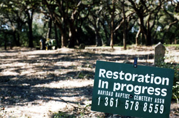
A sign of progress at the Navidad Baptist Cemetery |
Fayette County Cemeteries
|
A sign of progress at the Navidad Baptist Cemetery |
We are indebted to Kathy Carter, former director of the Fayette Heritage Archives and Museum, for the following cemetery information. In addition, the Archives staff will check their extensive cemetery database for you by e-mail. All you need is a surname. You do not need to know the name of the cemetery.If you have a photograph or information about a cemetery you'd like to contribute to this site, please contact Rox Ann Johnson.
29°55'23"N 96°54'20"W
Manton Cemetery
The Manton Family Cemetery is located on Golden Valley Lane one mile northeast of its junction with Old Plum Road. About twelve graves are surrounded by an old iron fence on top of a hill. Mary J. Manton, wife of Henry Manton, and their children John J. Manton and Ann Eliza all died in 1841 and are the earliest known graves in the cemetery. The grave of Nancy Knowles, wife of W. W. Knowles, is located just outside the fence.
Read more about the Manton Cemetery and see photos of some tombstones at the TexasEscapes website.
Photograph contributed by Gary E. McKee
Massadonia Hill Cemetery
Rabbs Prairie
The following is taken from Graves, Graves, Graves, copyrighted 1999, with the permission of the author, Norman C. Krischke. The full text and a map can be viewed at the Fayette Heritage Library, Museum & Archives:
Joe Cole recorded these graves 18 June 1959:
Massa Donia Hill Negro graves are located on Martin Ripper's farm four miles north of La Grange on Highway 77 in the Rabb's Praire area. Visited this cemetery June 18, 1959 with Larry Ripper, son of Martin.
Inscriptions on stones found:
William Demerson Died 3 Dec 1953, Aged 69 years.
Rosa Johnson Died 10 Jan 1957, Aged 80 yrs, 3 mos.
Ibby Moore, 17 Jan 1836, 10 Sep 1889
One grave in iron fence, no stone.This is one of the oldest Negro cemeteries in Fayette County; dates back to the slaves of Rabb and Castleman. The white cemetery is about 200 yards west. I had not taken the dates when I visited the white cemetery as I could not find this cemetery. There are lots of graves, possibly 200. Only found three grave stones. The cemetery is badly neglected.
Information from the files of Walter P. Freytag, May 1969:
Old cemetery, undoubtedly Negro, located north of Buddy's Place in the Rabb's Prairie area. Only stone found with legible inscription: Ibby Moore, 17 Jan 1836, 19 Sep 1889
In February 2017, Pete Hausmann and Bob and Carolyn Heinsohn revisited the cemetery. They were not able to locate the Demerson and Johnson graves. However, they did locate a few others:
Ida Cook born Aug. 18, 1869; died Dec 2, 1910; She was the sunshine of our home.
R Mc ; Died Nov 1889; Born in 184? - last line was below ground level.
Ibbi Moore was born 1806; died 1885; age 79
Ibby Moore, born in 1876; died Sept 10, 1889
L.E. Moore, member of Methos Church; died Mar 1889; born 1884
See also Survey of the Massadonia Hill Cemetery by Larry Ripper, which includes photographs and maps, at the Fayette Heritage Museum and Archives. Feel free to email Larry for more information regarding this cemetery.
Elijah Mathews Grave
Winchester
According to the Joe Cole Cemetery Survery of September 22, 1958, this site is near the Otto Noack farm on the left side of the dirt road which passes by the Noack farm [6 1/2 miles southwest of Winchester]. Cole states: "The grave is in the road and at present cannot be found but at one time it has a stone marker and picket fence. This old Negro owned a little farm here and lived on the farm about 70 years ago. He said he wanted to be buried on the farm and when he died, his family buried him on one corner of the farm near the road. Later the road was moved over and the grave was left in the road. George Carr and his wife told me of this grave. I later found the exact spot of the grave by the help of Otto Noack of Winchester, Tx."
Matula Cemetery
O'Quinn29°50'11"N 96°56'53"W
The Matula Family Cemetery is located on property now [1974] owned by Emil and Elvern Barton in the W. H. Toy League. The cemetery is situated on the west edge of a stock and fish tank 1.5 miles southwest of Cedar Cemetery, 0.15 mile southeast of Farm Road 609, and 0.1 mile west of County Road 362.
Joe Cole recorded this cemetery in his Spiral Notebook No. 1, West of the Colorado River, Site No. 33, as follows:
33. One mile east of O'Quinn on the west side of a road called old Peeler Road that leads from the La Grange-Gonzales Road to High Hill, there is a grave of a man named Matula. He has relatives in Schulenburg. There are several willow trees near the grave. (References: A. J. Hahn, W. D. Berry. Visited May 1958)Elvern Barton, nee Vogt, daughter of Julius Vogt, was born at the Vogt Homestead in the same house in which her father was born. She walked to and from Cedar School and passd by the cemetery many times. She remembers seeing a fence around the graves and states that her father said a man by the name of Matula and a child of his are buried there.
The grave fence was abou 10 X 10 feet square and was cared for by Julius Vogt until the time of his death. One rotted corner post with notches and square nails is still at the grave site. The corner post is turned by lathe; a work of art. The pickets were about four inches wide and were pointed at the top; they were not fancy. At one time there was a mesquite tree on the grave site. A sandstone one inch thick, five inches wide and eight inches long, without markings, is on the grave. - Norman C. Krischke
For more information about the Matula family and the location of the grave see the booklet, Matula Family Cemetery, written by Norman C. Krischke in 1974.
McCollum Family Cemetery
Winchester
From Joe Cole Cemetery Survey of 1958: On the Carl Noack farm 2 miles south of Winchester there is a very old public cemetery. The 7 graves listed are all that is left of this old cemetery. It is on a high bluff on the north bank of the Colorado River 200 yards down from the S & AP railroad bridge in a thicket of brush. Was told of this cemetery by M. V. Harris of Winchester.
From a sheet titled: Notes from Trip with M.V. Harris, Winchester area, March 27, 1964 -- On the Colorado Riverbank, land nows belongs to a Rosenburg contractor:
Florian Rudolph, Born 8 Feb, 1841, died 5 Dec., 1888.
H. L. S. - stone in German and brokenOn the same place as above, across ravine in fence:
McCollum, Alice, 14 Sep 1879 - 19 Sep 1879
McCollum, Andrew H., died 19 April 1866, age 68 years
McCollum, Eliza, died 24 April 1886, consort of A. H. McCollum, age 79 years
McCollum, Geo. W., 14 Jan 1881 - 24 Feb 1881
McCollum, James E., 10 Feb 1877 - 17 Apr 1877
McCollum, Tex. Amos C., 7 Sept 1845 - 30 Swp 1867
McCollum, Zachary T., 24 Jun 1848 - 20 Feb 1870
McCook Family Cemetery
Cistern
According to the Joe Cole Survey dated June 10, 1958 and August 5, 1958 this is "McCook, Negro, 5 graves. Tom McCook family, 5 graves. Tom's first wife Becky and one daughter. Three graves of Jirdon & Lula McCook. One mile east of Cistern on Brooks Creek. The graves are in the right of way of Hiway 2237 farm-to-market road. The highway dept. did not know of these 5 graves until they were destroyed. Just some more lost graves. ...also has two more graves of white children that I did not list. These two children were children of Ben Fuller who owned the land and lived there before the Civil War. The two children died and were buried there during the war. The McCook Negroes belonged to Fuller. After the war when the McCook Negroes were freed in 1867, Fuller sold the place to his former slave Tom McCook. Sometime later, Tom's wife Mollie, who was also a Fuller slave, died. She was buried by the two Fuller children on Oct. 7, 1900. Tom McCook died; he was buried by his wife Mollie. There are also two Negro children buried here; grandchildren of Tom & Mollie. There is one other grave - that of Mandy Harris, a daughter of Mollie, step-daughter of Tom. This statement was made to me Aug. 1, 1958 by Anna Browning, a daughter of Tom McCook. I am making this correction not that I think it is important but for the reason that the Negro woman, Anna was nice enough to call my attention to the fact that there was also the two graves of the two Fuller children there also."
Meentzen Grave
Nechanitz
This is a single burial on the family farm of Harvey & Rentate Meiners, located 2 1.2 miles south of Nechanitz on County Road 213. Mr. & Mrs. Meiners supplied this information in 1986.
Meentzen, Christian, died 1913
Jennie C. A. Holmgren Meitzen Grave
Originally located near Biegel Settlement
According to the Joe Cole Cemetery Survey on 1959: "Five miles northeast of Halsted, Texas on the Legler estate owned at present by Mrs. Charley Polasek is the grave of Professor Mierchin, sometimes spelled Mitchin. He was an early day school teacher and taught in this neighborhood. Died about 1880 near where he is buried. August 20, 1959"
In 1973-1974 the Lower Colorado River Authority of Austin purchased land in Fayette County for the construction of the Fayette Power Project. Several cemeteries were in the boundaries of the project acreage. All the affected burials were disinterred and moved to new sites. Descendants of the deceased were contacted and signed permits were obtained to allow the work to proceed. More than 125 burial sites were involved in the relocation project. The bodies were moved to the New La Grange City Cemetery; Old La Grange City Cemetery; New La Grange Black Cemetery; Fayetteville City Cemetery, New Biegel-December Family Cemetery (on LCRA property); Nordheim Cemetery in De Witt County; and the New Spring Hill Missionary Colored Baptist Church Cemetery.
Research done by LCRA indicated that this was the grave of "Jeny Meitzen" and she was moved to the Meitzen plot of the Fayetteville City Cemetery in a space immediately east of Edgar H. Meitzen. Her grave is unmarked. The Fayette Heritage Museum & Archives has copies of the release forms and permission forms that were signed by relatives so that the grave could be relocated.
Research done by Kathy Carter in March 1999 indicates that this is Jennie C. A. Holmgren Meitzen. She was born 16 September 1818 in Breslau, Germany. She died 17 March 1877 and was buried in the vicinity of the Biegel Settlement. She was the wife of Otto Meitzen and the mother of 16 children, most of whom died early. Several of her children were teachers. See "FFF-Meitzen" & "FF-Meitzen" files in the Fayette Heritage Archives for more information on this family.
Photograph of Jennie Meitzen contributed by Bob Richardson
Mexican Grave
Freyburg
The following is taken from Graves, Graves, Graves, copyrighted 1999, with the permission of the author, Norman C. Krischke. The full text and a map can be viewed at the Fayette Heritage Library, Museum & Archives:
Joe Cole reported this grave in January 1958. He acquired the information from his father, Norman R. Cole, who received it from his father, George W. Cole, Justice of the Peace at Muldoon for many years. Joe writes: "One grave of a Mexican. The grave is on the Bernard Romberg place near Freyburg. The Mexican, whose name is not known, was about 65 years of age. He worked for Romberg and died on the farm. George W. Cole, J.P, held the inquest on this death. Romberg was paid by the county to bury the man. His grave is southwest of the Romberg house in the pasture."
Johnny Koenig, of the O'Quinn area, had this to offer 4 october 1970: "The land once belonged to Will Loessin, son of Fritz Loessin. In 1930, at the time Will Loessin owned it, the grave site was in a pasture southwest of the old Romberg - Loessin house. I, Johnny Koenig, plowed up the pasture to make a field. I hit this one area several times and encountered sandstone rocks under the soil. Upon examination, it appeared the rocks were on edge as if placed that way and not flat as rocks would naturally lie. Because the rocks were on edge and localized in a small area, one would believe this was a grave at one time."
Miscellaneous Graves
Throughout Fayette County
The following is taken from Graves, Graves, Graves, copyrighted 1999, with the permission of the author, Norman C. Krischke. The booklet can be viewed at the Fayette Heritage Library, Museum & Archives. Note that some of these graves have individual files in the archives. These are linked to the appropriate entries.:
Joe Cole found many graves in out of the way places during his search for Fayette County graves and cemeteries from 1955 to 1958. These are some of them:
Negro graves near High Hill at the end of a road which leads to a house. Grave is north of the house in a pasture under an oak tree. 1 1/2 miles west of High Hill. Reference: Henry Beier
Graves of Adam Zumwalt and two daughters. Four miles south of Elm Grove on Zumwalt Prairie, now Sam Arnim's property.
One mile east of Cistern. Graves of McCook Negroes. They belonged to Ben Fuller. He sold to former slave, Thomas McCook. Two white children there too; children of Fuller. Mandy Harris, Negro, there too.
Two miles south of Muldoon in pasture belonging to Andy speed. Mrs. John Browning, Negro, of Muldoon, said graves were of Darrell Harkins and son.
Three miles west of Muldoon, Tansey Place, owned by Wallace Cherry of Muldoon. Grave of a child of William Henry Jones: Theophilus Lee Jones who died in 1864. No dates on stone but listed in Bible owned by Mrs. Frank Barta of Smithville, grand daughter of W. H. Jones.
Four Negro graves and possibly more. One was mother of Tom Banaster Scallorn of Schulenburg. Graves are on north side of Mulberry Creek on Adolf Kubena farm south of Charley Kalmus house.
Child's grave, possible child of Sidney and Queen St. Clair, on Willie Herzik farm which Mrs. Herzik's father bought from Faris. Did have a picket fence. Near old Columbus-Gonzales Road. 1 1/2 miles west and south of Engle. Ref: Mrs. Willie Herzik.
A Mexican man's grave who died at home of George and Alfred Salinas. They buried him 400 yards south of old Will Rightmer home. Once a road went by it. George W. Cole held inquest over the grave.
One mile north of Muldoon on east side of railroad near springs where old Dick Dunn Wood Spur once was. Two graves; one is Joe Elious who was killed by a Mexican on Buckner Creek. Joe was a Syrian by birth and a peddler of dry goods when the Muldoon rock quarry was first operating. George W. Cole, J.P., held the inquest; the county buried him. The other grave is of Dago John, a peddler; died at a Mexican house and was buried by the county.
Grave on bank of Live Oak Creek 6 miles west of Muldoon on the Clarence Ray place. Reference: Davis Holstein and Clarence Ray.
On Mrs. Willie Boehnke place on small branch which runs into Live Oak Creek. Reference: Mrs. Lillie Parker.
Two miles west of Muldoon on Live Oak Creek on old John Sullivan place. On of the first graveyards in this neighborhood. There are graves of uncles of Henry Pitman of Muldoon, Burleson, McClure, and Pitman. Reference: Lawrence Miller, Dade Miller and Henry Pitman.
One grave of a white girl, 18 years old Mary Aile or Iley on south side of Buckner Creek on W. C. Jackson place. Six miles west of Muldoon owned by Alton Boehnke. On bluff where Buckner Creek makes a big bend and runs southerly, sandstones. Ref: Edward Doms
Lone grave of a traveler buried by people in the neighborhood in the late 1860s. At that time the La Grange - Lockhart Road ran several miles farther north than now, crossing the railroad at about the present location and passing the old Haller place, then due west to Waterhole Branch 1/2 mile north of Edward Doms' home. This was the only water on this road from La Grange to Buckners Creek and Waterhole was a stopping place for travelers to cap and water teams. On George Vacek place and Ed Doms once saw it. 50 yards from the La Grange - Lockhart Road. A man was found dead and they buried him at the place of death.
Grave of 12 year old girl half way from Luck Store on Criswell Creek on east side of road. Was a white child. Ref: Jim Cain.
Grave of Mose Williams Negro family. Graves are lost now because they were in the middle of the road from La Grange to Gonzales. The graves were on Otto Loessin's place near Alligator Waterhole on Cedar Creek.
One-half mile north of Joe Rainosek home at old Cedar. North bank of Lightenburg Branch in Emil Schaeffer pasture were several graves in cedar-picket fence. Joe Rainosek thought they were Lewis or Lanes or Law.
Two miles west of La Grange, Highway 609, at home of Frank Vaclavic and F. L. Janca under live oak tree lies Jim Larkins of Muldoon. "When I was a kid, he was known as a Negro who could outrun anybody, white or black. It is said he outran a horse one time when Bunk Stagner tried to rope him.
On dirt road from Monument Hill to Cedar Cemetery. One and a half miles west of Monument Hill on north side of road on George Collin's place. Give graves on land once owned by Fritz Till. May be Till graves.
Dirt road from Monument hill to Cedar Cemetery on south side of road across from Gus Hausmann place on Mrs. Louis Eck place. Two graves; may be of the Minzenmeyer family.
Road from Monument Hill to Cedar Cemetery. South side on old Hermine Richers place near Mrs. Louis Eck. Grave of a child, grand daughter of Nordhausen, may be a Taylor child.
Grave on Joe Janda farm where Willrich and a Cook were move to Cedar Cemetery.
On Frank Boehm farm on road from Monument Hill to Cedar Cemetery. Three graves of Charley Ulrich's grand parents. Wording could not be read. Near site of old Hausmann Cotton Gin. On old Julia Frank place on road from Monument Hill to Cedar Cemetery. 200 yards north of George Sander home. Picket fence. Mrs. Julia Turnage, wife of W. L. Turnage of La Grange, keeps grave clean.
Behind August Janda barn at foot of rocky hill. Supposed to be graves of Huebner family.
Highway 77, 3 1/2 miles from La Grange on Ed Munk place. Two graves or maybe more. Mrs. Nordhausen keeps the graves clean.
Highway 77, off highway 1 mile, 4 miles from La Grange on Frank Janda place. Sixteen children's graves. Children of Frank Mueller who had eighteen children. Mrs. Frank Boehms was one of them.
One grave at Manton Springs supposed to be one of the Castleman's grave. Now lost. Died about 1830. 5 1/2 miles west of La Grange on Plum gravel road. Ref: Willie Snider.
Unmarked grave on west bank of Cedar Creek on high bluff between M.K.&T bridge and Colorado river. Killed when railroad was being built through Devil's Backbone. They had a large camp on this bluff. Ref: Joe Krenek
Three graves, north border of Buckners Creek, now owned by Julius Hunger; next to Frank's farm but across the road from it. Probably Knippels buried here. Seven miles west of La Grange on FM-609.
Mrs. Joe Krenek of la Grange who at one time lived on the Primm farm where he and seven other men were hauling wood from out of a cedar brake between Barton's Creek and Cedar Creek on Primm land where there is a bluff called New York Bluff, they found a skeleton of a human being face up. The last rains had washed the dirt from around the skeleton. When they started to move the skeleton, it fell apart and blew away. I myself, have seen this happen in west Texas when digging an Indian mound. A bone from a skeleton will blow away in 30 minutes after it is taken from the ground.
Near Primm Cemetery at Kirtlwy [Kirtley]. Negro cemetery now lost. Dr. Primm's slaves are buried here. Northeast of Alton Elias house, 50 yards in field. One was Stoglin brought by Primm from Wildsville, Louisiana when young.
Grave of a white girl at site of Bryant Sawmill on Cedar Creek one-half mile south of high bluff, one-half mile south of Frank Young Sawmill operated in the late 1850s; 2 miles south of Highway 71 on Cedar Creek, 1 1/2 miles east of Kirtley. Ref: Alfred Young, West Point.
Grave in road on Highway 71 1/4 mile west of underpass at West Point, north side of highway. Ref: Jim King.
Four or five graves on Cedar Creek, southwest of Kirtley near site of saw mill and the old tannery that was operated in the 1860s during the Civil War. Shoes and leather goods were made for the army graves may be of the Sorrelle family and others who lived at the old tannery during the war. Ref: Alfred Young, Mrs. Sue Robbins, West Point.
One grave on Steffan place south of Steffan Sawmill, 6 miles east of Winchester. I examined the graves with the iron rod and found 6 graves for sure, possibly more. It is most impossible to learn anything about a grave which is 65 years old or older. The people of 65 years ago most all passed on themselves.
One and a half miles south of Winchester, 200 yards from dirt road under oak trees; Amanda, wife of Fal Johnson.
Six and a half miles southwest of Winchester near Otto Noack farm on left side of road. Elijah Matthews, Negro, was buried here but road went over it.
Otto Noack farm, 400 yards south of Noack home. Only one monument left, that of Mary Elizabeth Hunt, daughter of Haden Hunt, died in 1867. Old Sanford Rainey home where there are other monuments.
Negro graves on George Gerdes farm. There was a Mathodist [Methodist] Church here called Gravel Hill. Graves: Grant, Newton, Brown and Blackburn.
Negro graves on David P. Croft farm four and a half miles east of Winchester. Graves: Ben Doker, Betsy Flowers, Will Taylor.
C. F. Noak estate, George Riddle 1/2 League. North bank of Rabbs Creek. Herbert Maddock had heard that a family died in less than a week and were buried on the place.
Two men killed in a gun battle. They were from Llano County. Three miles west of Fayetteville on FM 955. Ref: John Diving
Four miles west of La Grange on La Grange-Lockhart Road. Negro church and school here once maybe, but only one stone. Spencer Slack, died 1923, aged 40 years. Negro Mason
Monument Hill State Park
BluffMoore Cemetery
Also known as Mecklenburg Cemetery
Nechanitz/Rutersville
View photos, listing of grave sites, and information about the Moore Cemetery.
Moss Cemetery
Ledbetter, Texas
According to the Joe Cole Cemetery Survey of March 12, 1959, this site is four miles southwest of Ledbetter, Texas on the Moss Estate. Mr. Cole stated, "It seems as this family might have had some kind of epidemic as three of the family died in the year of 1899. From what I could learn, the Barnes and Moss families were related. All these deaths occurred in just a few years of each other. There is one lot fenced with three graves and no markers. Walter Moss's grave has an iron fence."
According to information supplied by Alfred Frenzel on November 1, 1963, this cemetery is located in northwest Fayette County, southwest of Ledbetter in the Bell Settlement Area. Mr. Frenzel found six marked graves in the cemetery (Mr. Cole did not list Elley Winters in his survey), and he states, "Otheres buried here have small sandstone markers with inscriptions. Many, no doubt, are buried here without markers of any kind." The information listed was compiled from Mr. Cole and Mr. Frenzel's reports by Kathy Carter.
Mt. Calvary Lutheran Cemetery
Also known as Trinity Hill Cemetery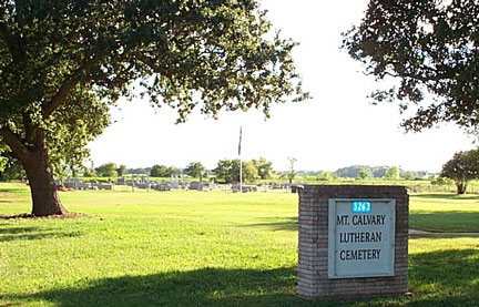
Near La Grange
Located on Old Plum Hwy, this cemetery was also the site of the Trinity Hill Lutheran School from 1892 until 1944.
Mt. Olive African Methodist-Episcopal Cemetery
Near West Point, Texas
29°56'00"N 97°01'28"W
This site was established in 1862, according to tombstone inscriptions, upon burial of A. Jeffson. It is located of State Hiway 71 at West Point 0.85 mile south of the highway on a private road called Justice Road. The site appears to be about 2 acres in size and is bounded by a barbed wire and cedar post fence with a gate at the SE corner. It is covered with brush and saplings.
The above information and following report are taken from the booklet, "Mt. Olive M.E. Cemetery," by Norman C. Krischke c.1999. The full report with maps is available in the cemetery files of the Fayette Heritage Archives.
View listing of grave sites in the Mt. Olive African Methodist-Episcopal Cemetery.
Mt. Olive Black Cemetery
Elm Grove
29°43'23"N 97°12'16"W
Joe Cole visited this cemetery on June 10, 1958 and reported: "About 2 miles south of Elm Grove and a little way north of the Arnim Oil field on a dirt road is a Negro cemetery. The first person buried here was a Negro man named McGee who was killed and thrown in Peach Creek near the cemetery. This happened right after the Civil War about 1869. There is a Negro church called Mt. Olive here." [Joe Cole #077W]
This is in the old Armstrong Colony community. According to Norman Krischke in his 1991 leaflet, Albrecht School District No. 39, William Fordtran donated land for a black church and cemetery here in 1886. The first school, a log cabin, was located in the east part of the cemetery. When that building became dilapidated, school was taught in the Mt. Olive Baptist Church across the road. Later a new church building was constructed on Armstrong Road about .3 miles north of Dozier Road. In 1918 a new school building was constructed on land immediately south of the church. Its teacherage still stands and is used as a church hall.
The Mt. Olive Black Cemetery is located on Dozier Road. The first dated burial is for Mariah Derry who died 3-17-1893. Mt. Olive Church is about 0.25 mile from the cemetery on County Road 170/Armstrong Road.
Kathy Carter & Helen Muras surveyed this site on 10/27/1986. There are many unmarked and undated graves in this cemetery.
Mount Pilgrim Cemetery
Fayetteville
See history and list of burials in the Mt. Pilgrim Cemetery.
Mt. Zion Cemetery
Plum
The Mt. Zion Cemetery is located next to the Church on Egypt at Plum. The cemetery was created in 1875 when the people of the Egypt Community purchased the land from a landowner by the name of Farris. The cemetery is home to 10 World War I Veterans, 2 World War II Veterans, 2 enlisted soldiers and 1 enlisted Air Forceman. Many old graves have no headstones. - Information provided by Estella Johnson
Mulberry Cemetery
Near St. John on Smith-Marek RoadView a list of burials and see photos of markers in the Mulberry Cemetery.
Muldoon Railroad Graves
1 miles north of Muldoon
According to Joe Cole, c. 1958, this site is on the east side of the railroad near of spring of water where the old Dick Dunn wood spur once was. Joe Elious was killed by a Mexican on Buckner's Creek. Joe Elious was a Serian by birth and a dry goods peddler when the Muldoon rock quarry was first operating. G. W. Cole, J.P held the inquest over Joe and the county buried him. Dago John was also a peddler and died at the home of a Mexican and was also buried by the county. -- Joe Cole #021W
Mullins Family Cemetery
Elm Grove
Joe Cole visited this site on May 12, 1958 and recorded: "A family cemetery one mile west of Elm Grove on the south side of the road 400 yards from road in a mesquite thicket. The road leads to Waelder by the double live oaks."
The Freytag Family Files folder "MULLINS" has a sheet from the Elm Grove church history written in 1955. According to it, Anna and Ira Mullins were the first two names to appear on the roll of charter members for the Elm Grove Missionary Baptist Church on Dec. 15, 1855. The church was located in Gonzales County on the banks of Peach Creek near the Fayette Coumty Line and also near the double live oak tree. Ira Mullins donated land for the first church site and his son, John W. Mullins, gave land for the present site.
Ira and Anna were married 1-11-1825 in Madison Co., Mississippi. They had 10 children, 8 of which are known: Ladora Ann, (the following from census records) Josephus, Malissa, John W., A. J., Philander, Robert D., & Madison M.
Ira and Anna were large slaveholders and some of their slaves were probably baptized members of the congregation.
Ira and Anna Mullins were both buried in the family cemetery which is just west of Peach Creek and some 3/4 mile south of the Waelder Road. It is not used anymore and has not been for many years; however, the one acre of land is still retained for cemetery purposes and it is stated so in all deeds (as of 1955).
No attempt by Museum staff to find this site has been made. There are probably others buried here. Anna and Ira's b. and d. dates in the following report are taken from census record. They both appear in 1870 but not in 1880.
Mullins, Anna, 1803 - ca 1875
Mullins, Ira, 1798 - ca 1875
Mullins Prairie Cemetery
Also known as Riser Cemetery
See list of burials, map, and history of Mullins Prairie Cemetery.
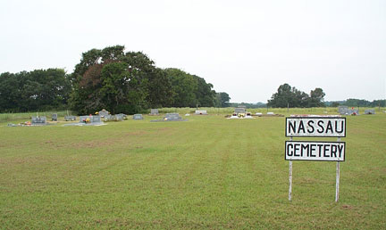
Nassau Cemetery
Round Top
30°02'49"N 96°38'14"W
Nassau Cemetery is located between Shelby and Round Top off FM 1457. The cemetery is near the junction of Nassau Road and Neumann Road. The cemetery is about one acre of meadow land, unfenced, and well kept. The Nassau School was at one time next to this cemetery. Land for the cemetery was given by a Mr. Stanley.
The oldest recorded grave is that of Wilhelmine Rummel who died Dec.26, 1930. Benjamin Schlabach and Rawlin F. Weber, who both died in 1945, served in World War II.
Family names on tombstones are those of Giese, Hall, Hoffmann, Kubala, Nitzsche, Reuter, Rummel, Schlabach, Smith, Voelkel, Weber, and Weyand.
See gravemarkers at the Nassau Cemetery for the Rummel family.
Nassau Black Cemetery
also known as Cornerville Cemetery
Round Top
See background information and a list of grave sites at the Nassau Black Cemetery.
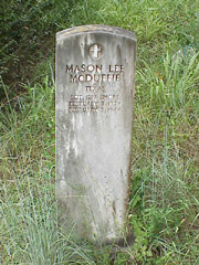
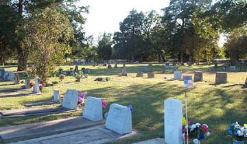
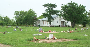
Navidad Baptist Cemetery
sometimes called American, Tubbs, or Lyons
Lyons/Schulenburg
View Navidad Baptist Cemetery description, photographs, list of burials, and links
Navidad Corinthian Baptist Church Cemetery
Schulenburg, also known as Brown's Chapel and Corinth Baptist Cemetery
Negro Grave
High HillThe following is taken from Graves, Graves, Graves, copyrighted 1999, with the permission of the author, Norman C. Krischke:
1925 was a dry year. Farmers put in their seed as usual and waited for rain but the rains didn't come. By harvest time there was nothing to harvest. Even the Johnson Grass was non-existent. Area farmers were forced to buy hay elsewhere at high prices to feed their cattle. The hay was brought in by railroad box car on the Southern Pacific and dumped right beside the tracks on some adjacent farms to feed the starving animals. Hay became so scarce that the unscrupulous raked up the barnyard straw along with some manure, mixed it with good hay, and sold it at the prevailing high prices.
In the latter part of the year the rains came. The area normally receives about 30 inches of rain for the year. It seemed that all thirty inches fell in October and November of 1925. The area was flooded and the ground was extremely soggy.
Louis Petrash looked over his land after the flood waters of Rocky Creek subsided and found something unusual in a grove of live oak trees southeast of his house. There was a hole in the ground about 3 feet wide, 6 feet long and 1 foot deep. It appeared to him to be a grave over which the soil had settled because of the wetness. He talked to some of the old timers of his neighborhood and they told him that it was, indeed, a grave. They related this story:
"Sometime shortly after the Civil War, about 1868, a Negro had violated the law, probably theft of cattle or a horse, and had run from the authorities. A posse was mounted which followed his trail to Rocky Creek. After an extensive search, they found him in a thicket on a high bank of a small branch just north of Rocky Creek. He tried to escape and the posse shot him dead. He was buried where he fell."
During the years the brush was removed from the site and in the 1950s the live oak trees were cut down. In the 1960s the high banks of the branch were bulldozed down and the area was planted in Coastal Bermuda. Pecan trees grow along the branch today. There is nothing there today to mark the exact site of the grave.
Negro Grave
SchulenburgThe following is taken from Graves, Graves, Graves, copyrighted 1999, with the permission of the author, Norman C. Krischke:
When Frank Mendel bought land in the 1920s in the J. A. Whitehurst Survey about 4 miles west of Schulenburg, Frank Beck, who lived nearby, cautioned him not to plow over the Negro grave in his field. Frank Beck told his son, August, about the grave and the information was provided to the author in November 1970. August pointed ou the exact location of the burial. The man is buried on the turn-row or fence line at the second fence north of County Road 433 and about half way between the east and west barbed wire fences. There were several trees at the site long ago but only one small hackberry remains. A large pecan tree is located on the same fence line half way between the grave and County Road 432 or Bryant Road. There never was a stone of any kind at the grave and the person's name and dates are not known.
Norton Grave?
Schulenburg
The following is taken from Graves, Graves, Graves, copyrighted 1999, with the permission of the author, Norman C. Krischke:
Thre are several rocks in the shape of a partial rectangle on the property of Fred Hermis, the old Peter Vasek Place, on the south edge of the Levi Bostick League about three miles southwest of Schulenburg which may or may not mark an old grave. - Info from Ben Shimek 5 January 1974
Fred Hermis, who married Martha Vasek, daughter of Peter Vasek, bought the land in the Thomas Taylor League from O. H. Wolters and the land in the Levi Bostick League from Peter Vasek. He moved onto the property in 1934. The large live oak tree in front of the house, built in 1944, markes the dividing line between the two leagues. Mr. Hermis stated that the rocks were discovered in 1963. The soil had washed away exposing the rocks which formed a complete outline 2 feet wide and five or six feet long. He is not sure that this is a grave. He states that neither the Vaseks nor the Hermis' have a relative buried there and, if it is a grave, only the Nortons, own owned the property long ago could have someone buried there. - Info from Fred Hermis 10 January 1974
The different types of rock suggest that a grave exists. The width of 2 feet suggests the grave is that of a youngster.
The rocks are not a natural sandstone formation of identical characteristics but are different in color and texture placed side by side in a row. The enlarged sketch following shows the relation of the rocks to the house and live oak tree.
Rudolph Jurica told Fred Hermis that Norton was supposed to have buried $1600.00 in silver coin on the place and, to his knowledge, has not been found.
A member of the Hermis family used wires as Divining Rods to look for the treasure. He walked over the property with the wires and got a good, strong pull in front of the garage. A hole was dug and a large kerosene stove was found. They had to cover the hole the next morning to get the car out of the garage to go to church.
A young man named Norton visited the farm several times with a treasure map and tried to find a specific spot. His last visit was in 1962. Apparently, he gave up his search with this remark. "All the limbs are broken off the trees." - Info from Fred Hermis 10 January 1974
The northwest limb of the oak tree had, long ago, fallen away and the Mulberry Tree had died and rotted away.
There is no positive proof that this is a grave, however, it is quite possible that a child of James M. and Nellie Norton is buried here.